Olly P
-
Posts
117 -
Joined
-
Last visited
Everything posted by Olly P
-
Using "off the shelf house plans" yes or no?
Olly P replied to Olly P's topic in New House & Self Build Design
@dpmiller , the link for your plans doesn't work but i watched the fly around video in your intro. Looks fantastic! We really like the look of this: http://www.irish-house-plans.com/dorm_catalog/dorm141/dorm141.html. Are you going block and brick or TF? -
Using "off the shelf house plans" yes or no?
Olly P replied to Olly P's topic in New House & Self Build Design
Thanks for the link @dpmiller. I've had good look at the website and one of the dormer bungalows pretty much perfect for what we want. I take it the firm customised it to what you wanted and a local architect put it on a site drawing for you? -
Using "off the shelf house plans" yes or no?
Olly P replied to Olly P's topic in New House & Self Build Design
Alot of good advice there thanks all. My question was to find out if anyone on this forum had taken this route of using off the shelf plans instead of getting an architect to start from scratch and if it was successful or not. My planning consultant is applying for OPP with a location and site plan only-so no drawings required at this stage, but my research on house design and planning is only in preparation of the OPP getting passed. If it doesn't- well I haven't spent any money only time and I have enjoyed it to be honest! If it gets passed, I've made a head start and know a route to take. My site is a section of flat field between a large dormer bungalow and a farm building, opposite houses built in 2000's and old houses of various age, so it's hard to judge what would be in keeping with its surroundings but I'm looking towards a large dormer bungalow which would suit our requirements and fit in with next door. -
Hi all. Currently we are about to apply for Outline Planning at our site so I am (and have been for the last 9 months) doing a lot of research on Planning Policies and house design etc. In the 1960's my father and his brother built around 10 brick bungalows that he said he bought the bungalow plans out of a magazine in a newsagent.. Literally off the shelf!! He then took the building plans to a local architect who positioned them on to the site plan ready for submitting to LPA. This saved a significant amount of money on custom house design as they were happy with the off the shelf design albeit they did tweak them. My question is have many of you had success in buying off the shelf plans? Such as what www.houseplansdirect.co.uk provide? Best Regards Oliver
-
Currently I am trying to find the settlement boundary that the Planning officer has stated my site is "out with". On my LPA/district interactive website it shows current and past Planning Applications, development boundaries, green gap areas, bus stops, postcode areas, parish councils etc etc but no settlement boundaries are shown. If nothing is there How do the planning officers identify What is within out with a settlement boundary?
-
Many thanks for your reply. The map on Google maps/earth is a very old one and the car park that was where the agri building is now was used by workers when the housing estate opposite was being developed.
-

-
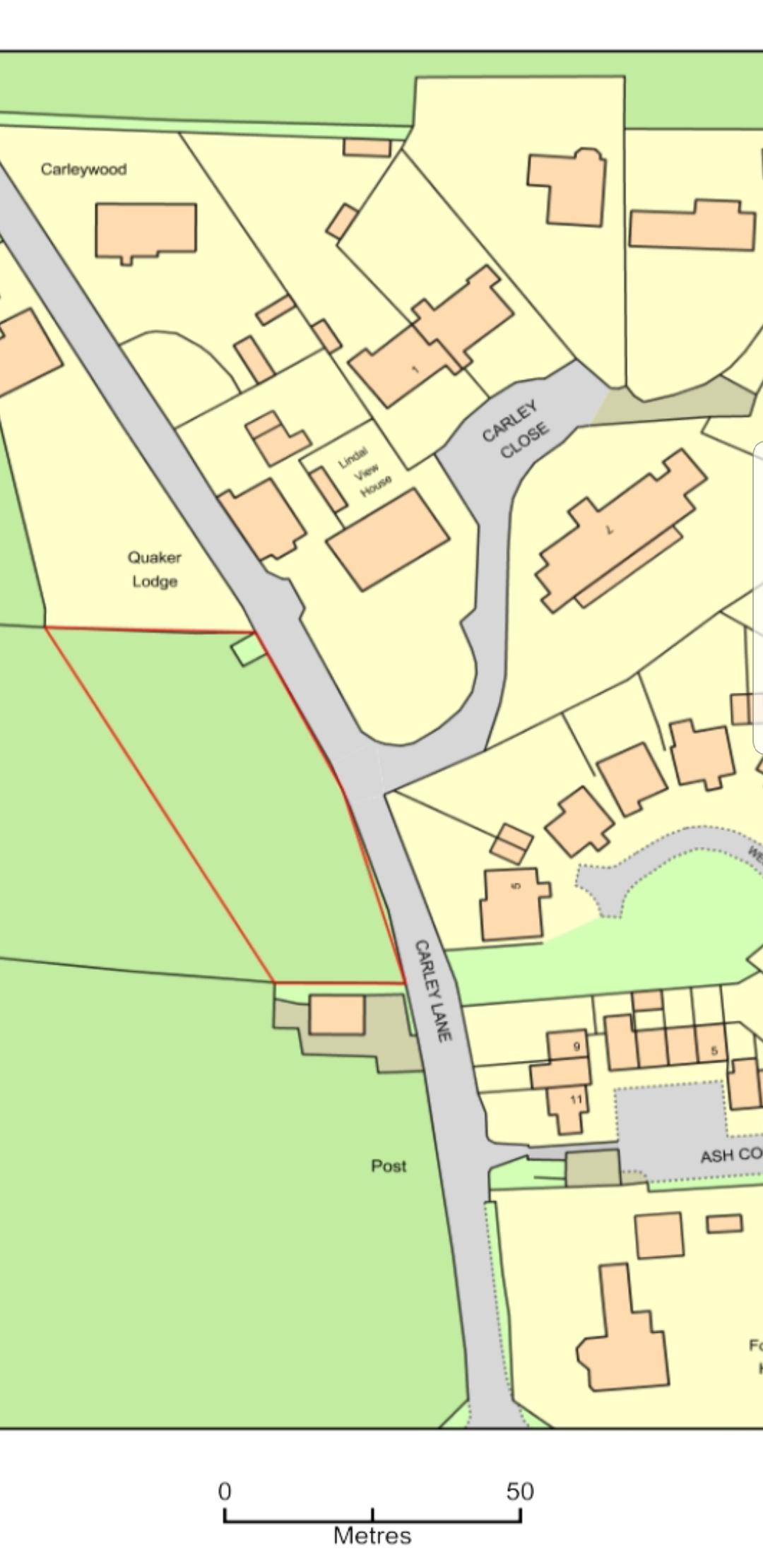
I will post a map of the land shortly
-
This is exactly what our planning officer has said in our Pre Planning App response!!
-
A useful read which is relative to our situation and I will pass onto my planning consultant. Our plot is a field on the edge of a settlement with dwellings opposite it, sited between one dwelling and a agricultural building. We have had a pre planning app response earlier this year which the planning officer has stated that he refers to the site as " rounding off or infill" but wouldn't support it as it is regarded as an isolated dwelling into open countryside, even though it would be aligned to the other buildings existing. That said, we are still pursuing and are applying for Outline PP early next month. From watching other PP applications going through recently, it seems that the ones with no objections have an easier time going through and that the planning officers and committee members are prepared to be more receptive to developments on the edge of settlements. Next step for me I think is to knock on the neighbours doors with a bottle of wine... wish me luck!!