james505
-
Posts
3 -
Joined
-
Last visited
Everything posted by james505
-
Datum Point. How to measure Site Levels. Advice needed
james505 replied to james505's topic in Surveyors & Architects
Thank you ETC, so I set a datum point as the road in front of my property and set that as 100.00mm then I measure up from that, to the top of my dropped kerb say 100.05mm and then the grass as 100.15 -
Datum Point. How to measure Site Levels. Advice needed
james505 replied to james505's topic in Surveyors & Architects
Thank you. I have just seen a plan that I think it using a 10,000m scale as you suggested and it using a BT box as a Datum point. I will try and attach the file to see if it is an example I should follow. Thank you for your help. PROPOSED_PARKING_LAYOUT-8023466.pdf -
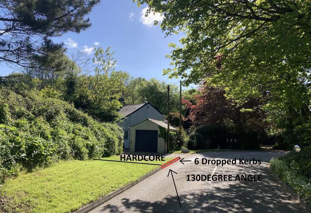
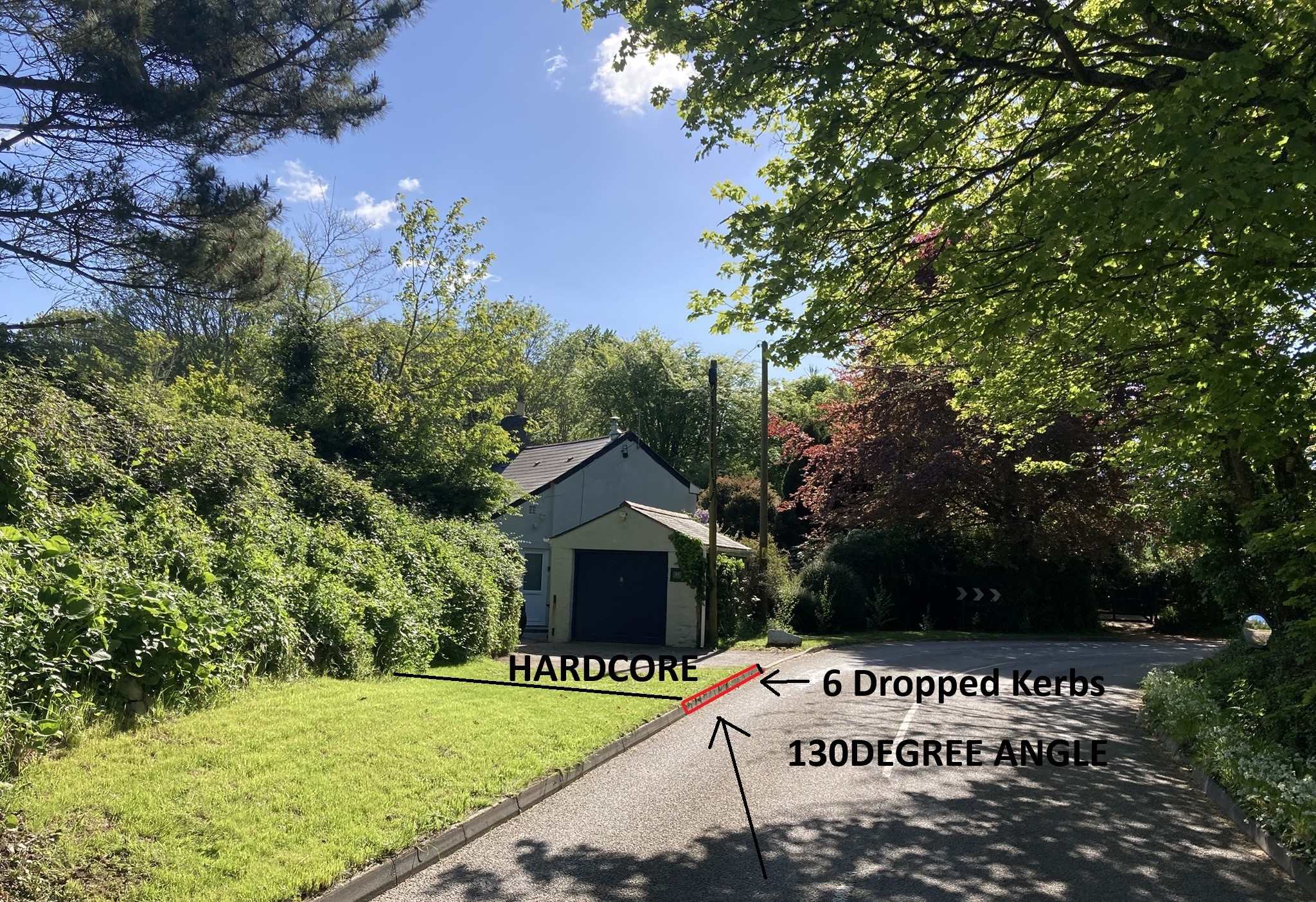
Hello, I submitted a planning application to drop a further 6 kerbs outside my property. My local council has come back and asked me to add existing and proposed site levels to my Site Plan. I cannot afford to approach a surveyor, so I have been researching how to measure site levels. I believe that once I have established a datum point, i can simply use string and a spirit level to take measurements on how the site levels increase or decrease in relation to my datum point. Can I just place a brick on the centre of the site and measure levels out to each of my boundaries in a 360 fashion and measure and plot the site levels in relation to that brick? I have attached a photo showing the site to provide some context. I would be grateful for any responses. This is an extract from my LPA "Any proposal involving new buildings or floor space and any groundworks e.g. access tracks, hard surfaced areas etc. require the submission of existing site levels. This information can be shown on the existing Site Plan. Offsite levels of land and buildings immediately adjoining the site are also useful.* Thank you